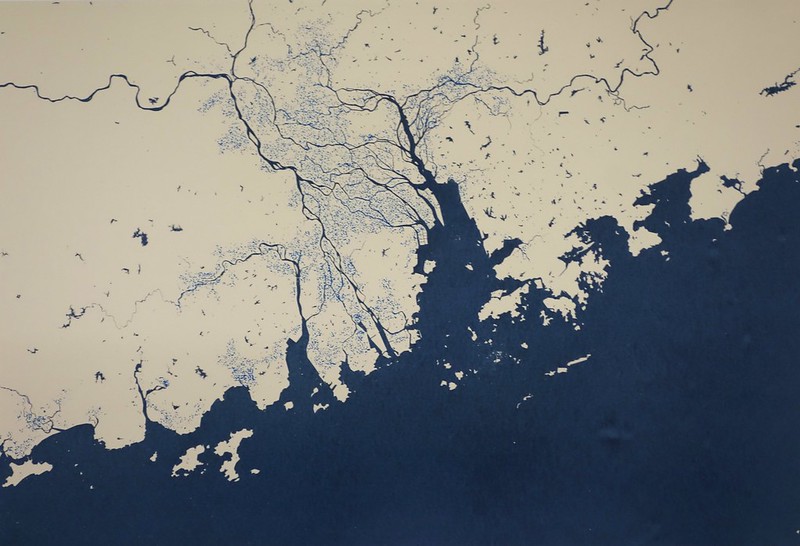
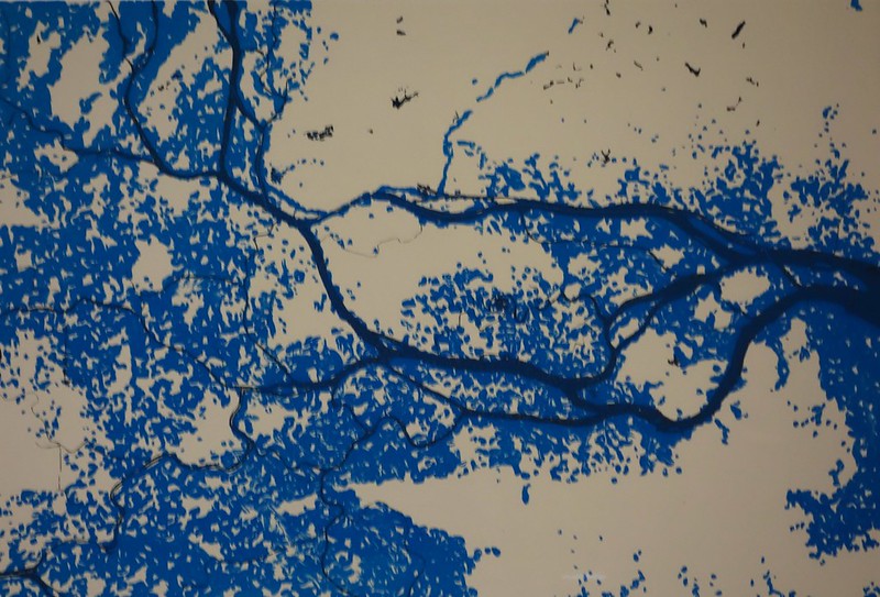
Pearl River Delta region. Light blue colour indicates current land below sea level.
Silty river delta,
Fishing, farming, trading –
Everyday life.
Of all the world’s cities, the great Guangzhou “megalopolis” is now considered the single place most likely to suffer catastrophic damage from rising sea-levels. The maps shown here indicate some possible future scenarios for the Pearl River Delta. Much of the land in the Delta is already below sea level, so industry and housing are vulnerable to flooding:
Factories, shipping,
“Special Economic Zone” –
Everyday life.
Sea level rise is influenced by a wide range of factors. The most obvious causes are associated with global warming: the thermal expansion of the oceans, and the melting of glaciers and Antarctic ice sheets. More complex local factors include tidal variations, warm and cool ocean currents, the building of sea-walls to hold back the water, and the damming of rivers further upstream.
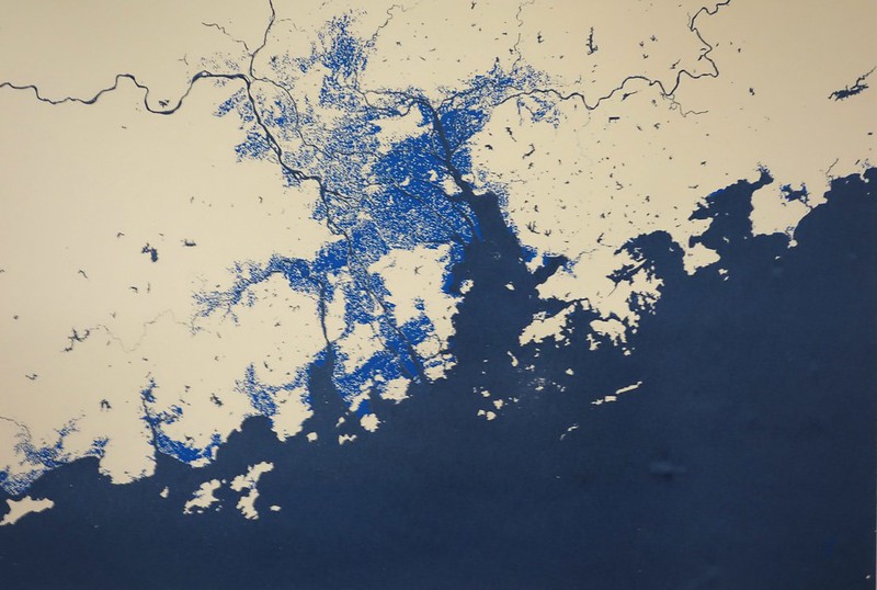
Pearl River Delta region – light blue colour indicates potential flooding caused by a one metre sea level rise.
The screenprinted maps shown here cannot show the full complexity of this situation. Rather, they employ “bathtub modelling” – a simple way of showing what might happen if seawaters were to creep up onto the land in a uniform way.
Although it is nearly impossible to predict the local extent of sea level rise with any precision, the Intergovernmental Panel on Climate Change suggests that a global sea level rise of 98cm by the year 2100 is very likely. This corresponds roughly to the “one metre” maps presented in this exhibition. A “five metre” map is also shown – which is entirely possible if polar ice deposit melting continues to accelerate.
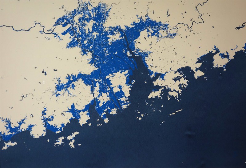
Pearl River Delta region – light blue colour indicates potential flooding caused by a five metre sea level rise.
Massive migration.
“Mega-projects”. Modernisation:
Everyday life.
The animated map depicts a massive “60 metre” sea level rise, which is a possible scenario if all the world’s polar ice was to melt.
Pearl River Delta Flood Animation from Luca Zoid on Vimeo.
The prosperity of the Delta has always been based on water. And the future of Guangzhou is going to be increasingly watery:
How will the city evolve?
What kinds of decisions will the city make to survive over the next hundred years? What does “survival” even mean?
And what do the people who live here think about all this?
Habitat, transport,
Sustenance, trash disposal:
Everyday life.
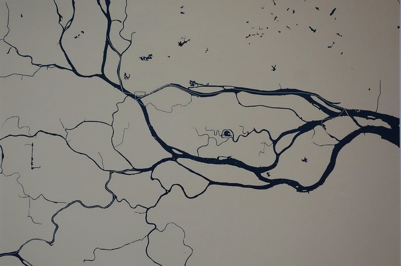
Haizhu area of Guangzhou – this map shows current river arrangements in this heavily populated zone.
Haizhu area of Guangzhou – light blue colour on this map indicates possible effect of one metre sea level rise.
This investigation is ongoing, and your correspondence is welcome.
Email: lucas@guangzhou-delta-haiku.net